


Tất cả sản phẩm
-
Máy quang phổ màu di động
-
Màu sắc phù hợp Máy quang phổ
-
Sơn phù hợp Máy quang phổ
-
Máy đo quang phổ di động
-
Dụng cụ đo Haze
-
Máy ảnh chụp ảnh siêu kính
-
Phòng thí nghiệm đo màu
-
Máy đo độ bóng cầm tay
-
Đồng hồ đo độ bóng kỹ thuật số
-
Đa góc Gloss Meter
-
Hộp đèn màu phù hợp
-
Phần mềm khớp màu
-
Phụ kiện quang phổ
-
Pantone Color Swatches
-
Máy đo độ truyền ánh sáng
-
 Yulita JocomCảm ơn bạn rất nhiều vì sự hỗ trợ của bạn về chất lượng sản phẩm và cung cấp giá cả cạnh tranh để giúp chúng tôi mở rộng hoạt động tiếp thị địa phương trong 2 năm qua.
 -
Johanna BrathwaiteMáy quang phổ thực sự mang đến cho chúng ta rất nhiều sự trợ giúp về kiểm soát chất lượng màu nhựa.
-
Muhammad ImranCông cụ và phần mềm hoạt động hoàn hảo. Cảm ơn bạn rất nhiều vì dịch vụ khách hàng tuyệt vời của bạn.
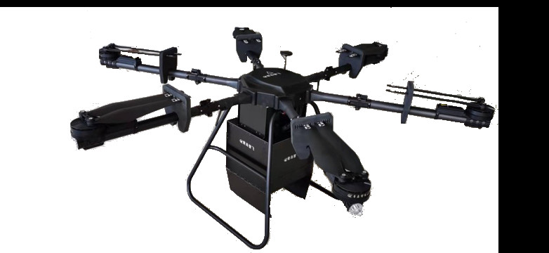
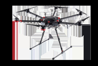
FS60- UAV Hyperspectral Imaging Camera for High-Stability Spectral Image Acquisition


Liên hệ với tôi để có mẫu và phiếu giảm giá miễn phí.
Whatsapp:0086 18588475571
Wechat: 0086 18588475571
Ứng dụng trò chuyện: sales10@aixton.com
Nếu bạn có bất kỳ mối quan tâm nào, chúng tôi cung cấp trợ giúp trực tuyến 24 giờ.
xThông tin chi tiết sản phẩm
| Độ chính xác vị trí RTK | CỐ ĐỊNH RTK: 1 cm+1 ppm (ngang) 1,5 cm+1 ppm (dọc) | tần số làm việc | 2,4000-2,4835 GHz 5,725-5,850 GHz |
|---|---|---|---|
| tốc độ hình ảnh | Toàn dải 128Hz, 3300Hz có thể đạt được sau ROI | SNR (Đỉnh) | 600/1 |
| Cấp bảo vệ IP | IP45 | Hệ thống chiếu sáng | Chiếu sáng thụ động (không có nguồn sáng) |
| Thời gian bay tối đa | 55 phút | Dải quang phổ | 400-1000nm |
| phương pháp quang phổ | Ghê tai | Tốc độ bay ngang tối đa | Chế độ S: 23 m/s, chế độ P: 17 m/s |
Mô tả sản phẩm
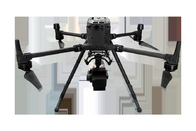
FS60- UAV hyperspectral measurement system
The FS60 unmanned Superspectral Survey system used a high signal-to-noise ratio and a high-speed CCD imaging device to ensure highly stable spectral imaging. The independently developed low-efficiency image processing calculation method greatly increased the flight time of finished products and lowered the system's energy consumption.
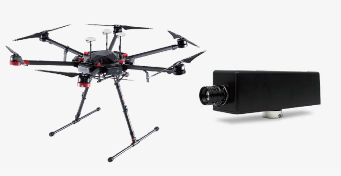
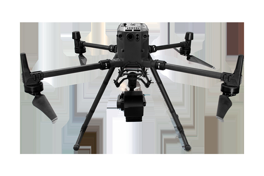
♦Dji M300RTK (DJI M600Pro optional) is used as the flight bearing platform.
♦Ultra-high speed spectral scanning imaging device with high signal-to-noise ratio provides high stability of
spectral image acquisition.
♦A self-developed high efficiency and low power image processing algorithm is adopted to greatly prolong the
flight time of the whole machine and reduce the power consumption of the system.
♦Through real-time measurement of spectral image information of plants, water, soil and other ground objects, it
can be applied to precision agriculture, crop growth and yield assessment, forest disease and insect pest
monitoring and fire monitoring, coastline and marine environmental monitoring, lake and watershed environ
mental monitoring and other applications.
♦The system design is compact and the main spectral resolution of the imaging spectrometer is up to 2.5nm.
Components: high stability head, hyperspectral imager, embedded data acquisition and processing storage
unit, wireless image transmission system, GPS-RTK navigation system, ground receiving workstation, ground
control system, reflectance calibration board.
Applications
Technical parameters
Flight unit parameters (M300RTK)
| Size | Dimensions (expanded, excluding blades) : 810 x 670 x 430 mm (L x W x H) |
| Dimensions (folded, including blades) : 430 x 420 x 430 mm (L x W x H) | |
| Symmetrical motor wheelbase | 895 mm |
| Weight (including lower | Air weight (without battery) : 3.6kg |
| single head bracket) | Air weight (including dual batteries) : 6.3kg |
| Maximum load of single gimbal damping ball | 930g |
| Maximum takeoff weight | 9 kg |
| Working frequency | 2.4000-2.4835 GHz 5.725-5.850 GHz |
| Transmit power (EIRP) | 2.4000-2.4835 GHz: |
| 29.5 dBm(FCC);18.5dBm(CE)18.5 dBm(SRRC);18.5dBm(MIC) | |
| 5.725-5.850 GHz:28.5 dBm(FCC);12.5dBm(CE)28.5 dBm(SRRC) | |
| Hover accuracy (P-GPS) | Vertical: ± 0.1m (when visual positioning works normally) ± 0.5m (when GPS works normally) |
| ± 0.1m (when RTK positioning works normally) | |
| Level: ± 0.3m (when visual positioning works normally) ± 1.5m (when GPS works normally) | |
| ± 0.1m (when RTK positioning works normally) | |
| RTK position accuracy | RTK FIX: 1 cm+1 ppm (horizontal) 1.5 cm+1 ppm (vertical) |
| Maximum angular velocity of rotation | Pitch axis: 300°/s Heading axis: 100°/s |
| Maximum pitch angle | 30° (P mode with forward-vision system enabled: 25°) |
| Maximum rate of rise | S mode: 6 m/s,P mode: 5 m/s |
| Maximum velocity of descent (vertical) | S mode: 5 m/s,P mode: 4 m/s |
| Maximum sloping descent rate | S mode: 7 m/s |
| Maximum horizontal flight speed | S mode: 23 m/s,P mode: 17 m/s |
| Maximum flight altitude | 5000 m (2110 blade, takeoff weight ≤7 kg) / 7000 m (2195 plateau quiet blade, takeoff weight ≤7 kg) |
| Maximum wind speed tolerance | 15m/s (12m/s during takeoff and landing) |
| Maximum flight time | 55 min |
| Supports the gimbal installation mode | Single holder set at the bottom, single holder set at the top, double holder set at the bottom, single holder set |
| at the bottom + single holder set at the top, double holder set at the bottom + single holder set at the top | |
| IP protection level | IP45 |
| GNSS | GPS+GLONASS+BeiDou+Galileo |
| Operating ambient temperature | -20°C to 50°C |
Hyperspectral camera parameters
| Lighting system | Passive lighting (without light source) |
| Spectroscopic methods | Grating |
| Spectral range | 400-1000nm |
| Spectral band | 1200 |
| Resolution of spectrum | 2.5nm |
| Slit width | 25um |
| Transmission efficiency | >60% |
| Stray light | <0.5% |
| Number of spatial pixels | Maximum 1920 (software configurable) |
| Pixel size | 5.86um |
| Imaging speed | Full band 128Hz, 3300Hz can be achieved after ROI |
| Detector | CMOS |
| SNR(Peak) | 600/1 |
| The camera output | USB3.0 or Gigabit network |
| The camera interface | C-Mount |
| Accessories | USB3.0 transmission line or Gigabit network transmission line |
| ROI | Multiple regions |
| Embedded data acquisition and processing storage unit | I7 processor 512GSSD storage |
![]()
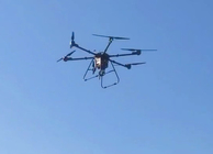
♦Easy to operate, it can achieve single operation without professional
drone operator.
♦The ground station can be used to observe the sampling location of the
aircraft in real time, and the ground station can be used to set the
preview and correction functions of the route data collected
point-by-point: radiosity correction, reflectance correction and regional
correction support batch processing.
♦Real-time common vegetation index calculation function.
♦Support custom real-time analysis model input function.
♦ENVI is perfectly compatible with multiple data formats.
Sản phẩm khuyến cáo